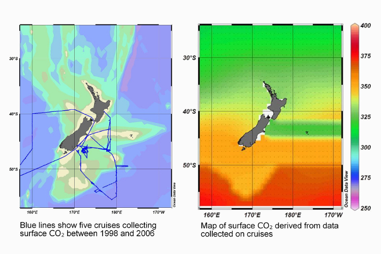

Data from cruises around New Zealand has been used to map CO2 in surface waters. This will be combined with satellite data to create a more accurate picture.
Data from cruises around New Zealand has been used to map CO2 in surface waters. This will be combined with satellite data to create a more accurate picture.